Plan
01
Five fronts where construction projects lose time, money and accuracy, and why monthly site walks and disconnected spreadsheets can no longer keep up.


02
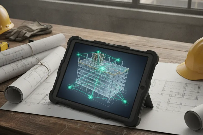
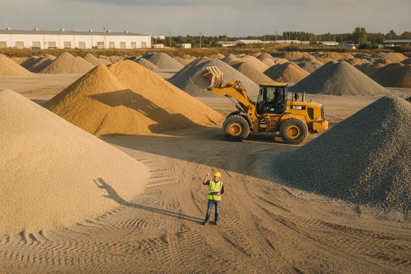
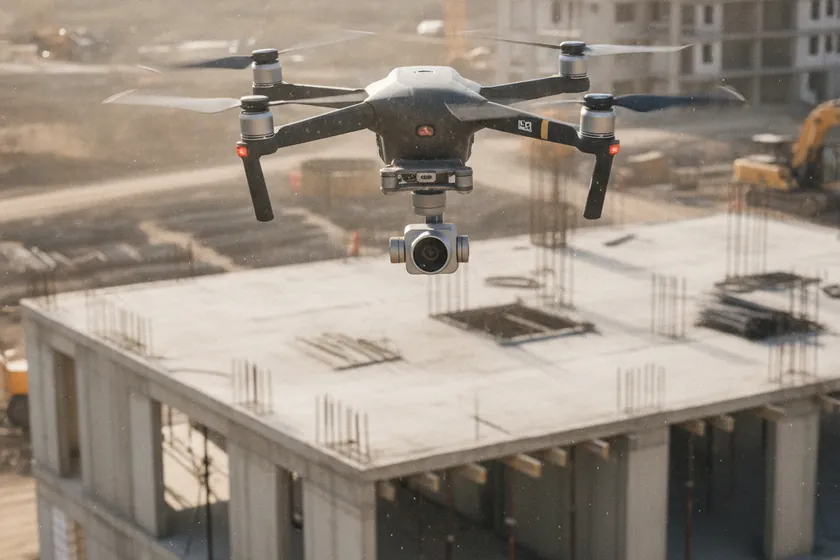
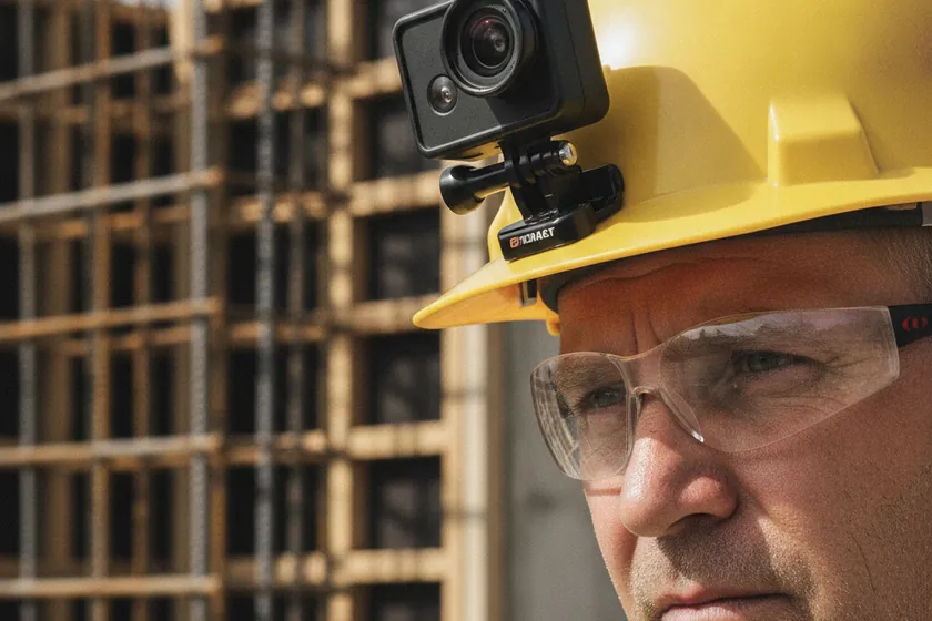
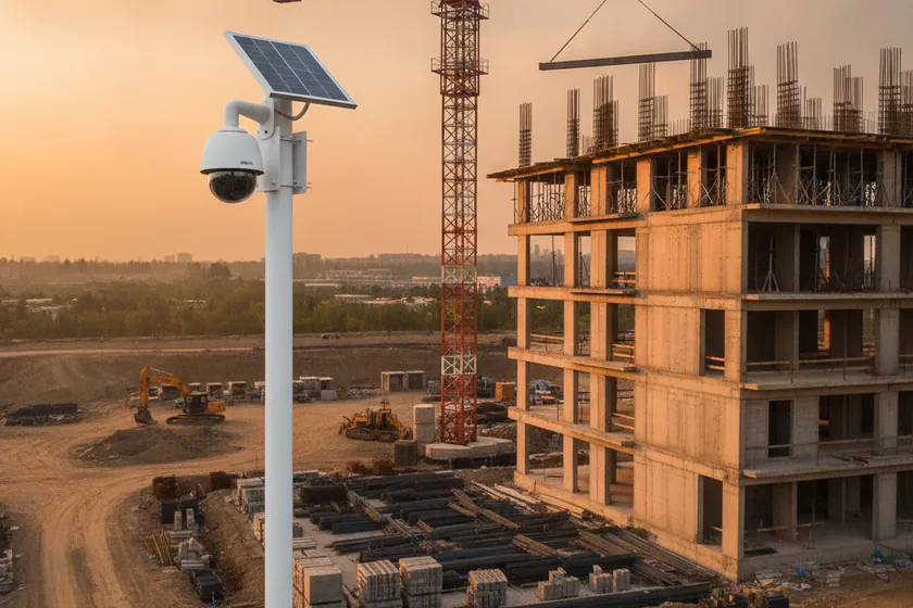
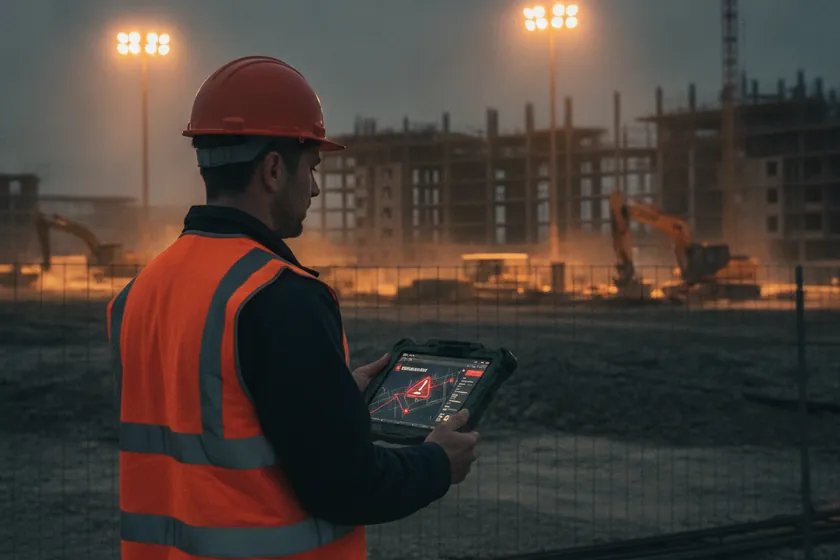
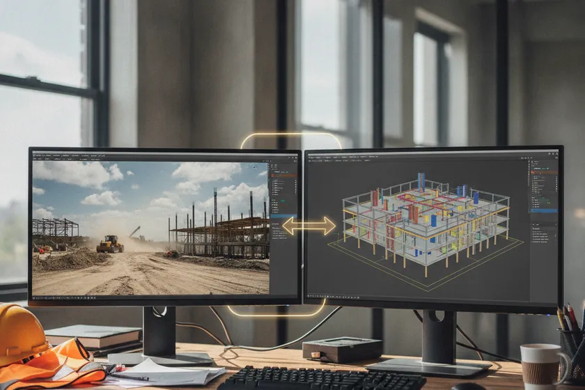
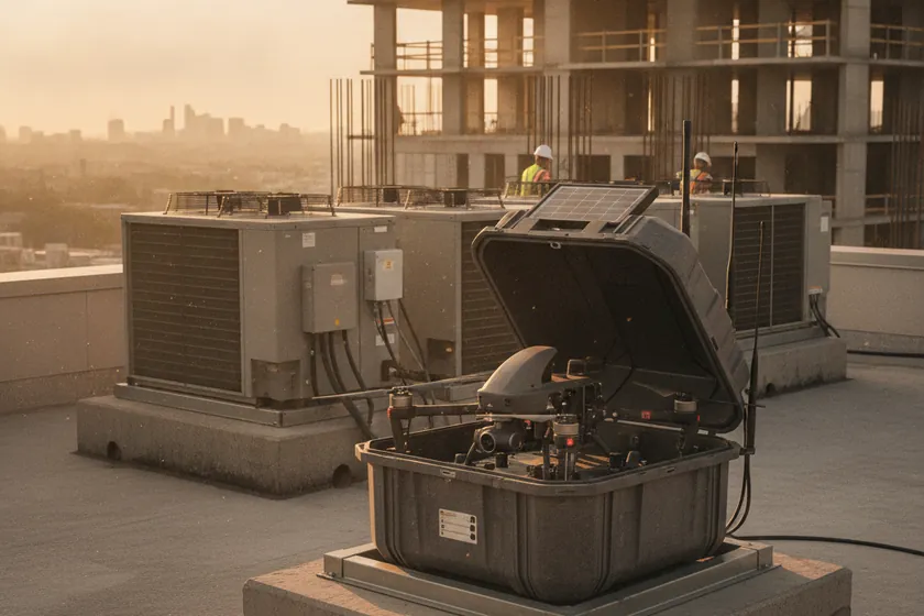
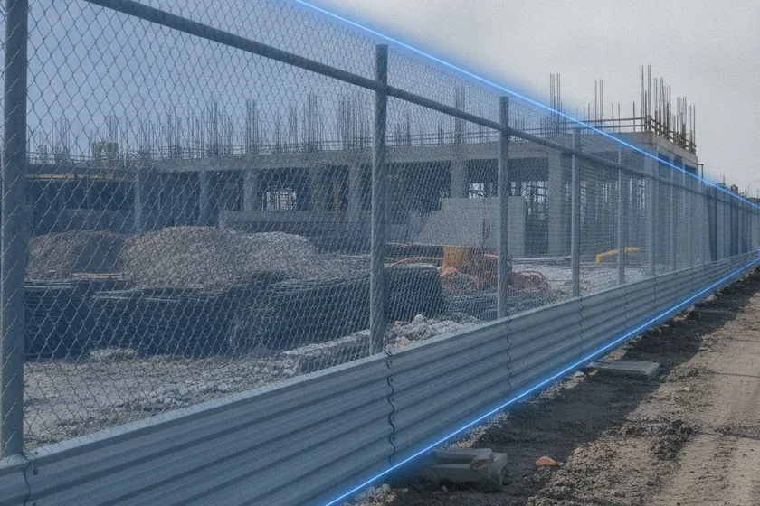
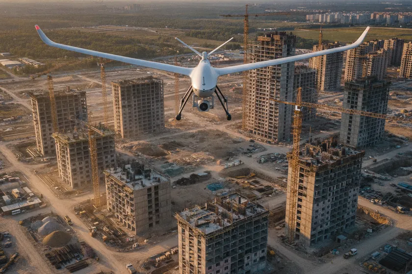
One AI for every eye on site: autonomous drone capture, fixed CCTV towers and worker helmet-cams feed a single model that turns pixels into 12 construction-specific classes, automated progress against BIM, centimetre 3D maps, stockpile volumes and deviation alerts — all on your existing cameras and KSA data residency.


03
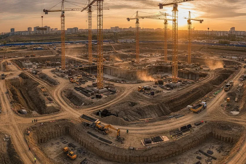
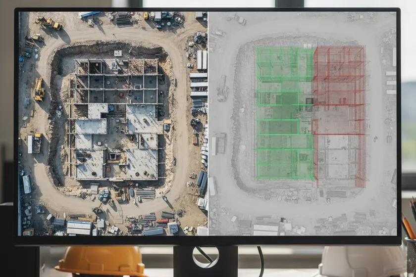
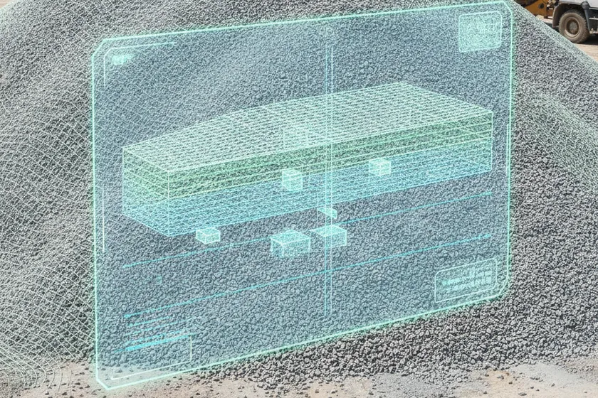
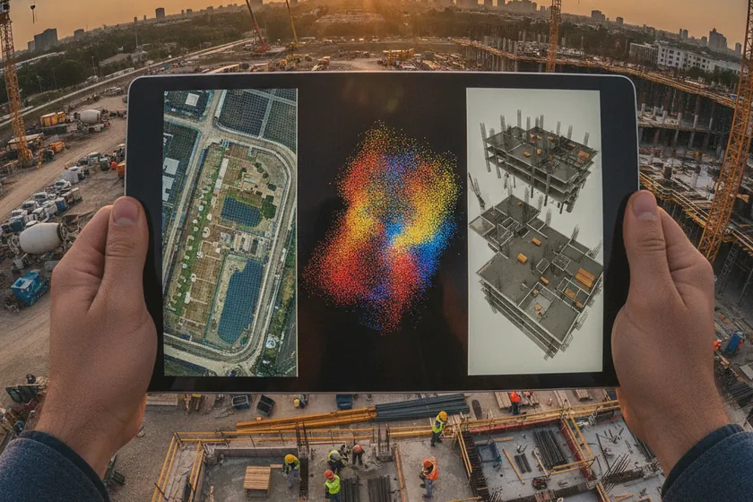
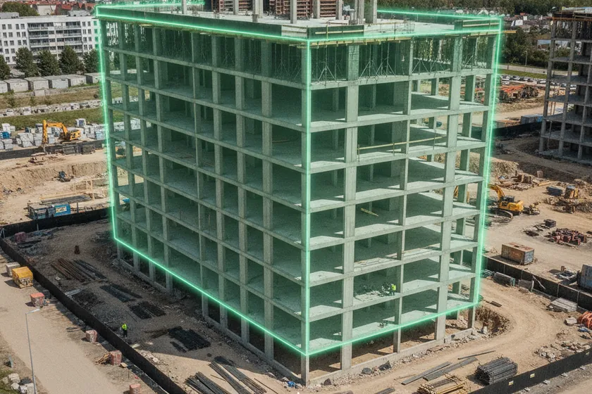
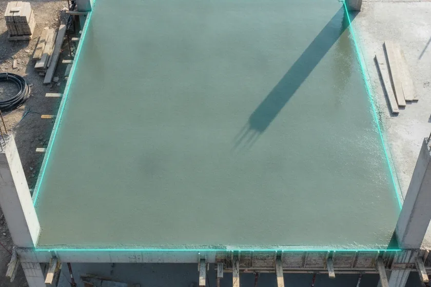
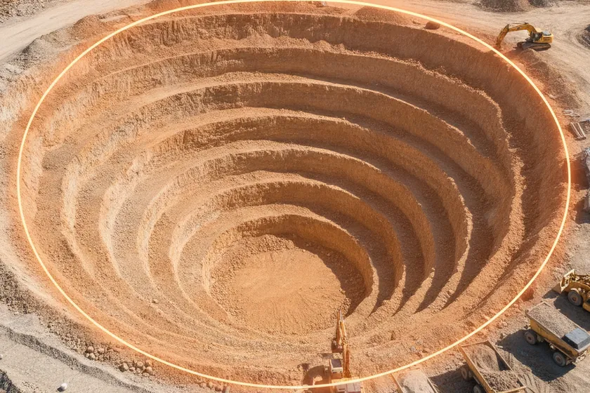
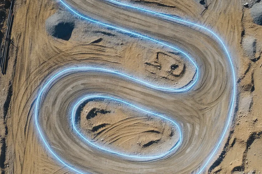
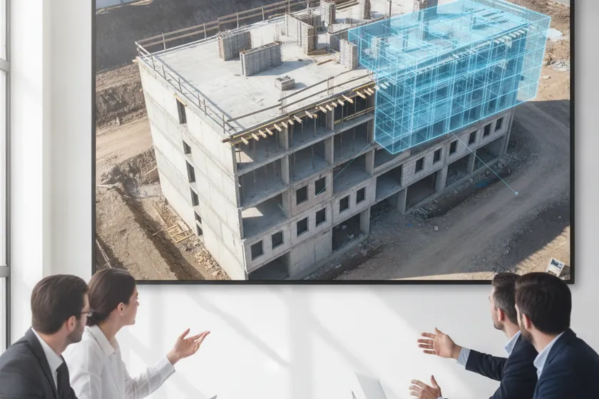
Our solution turns every drone flight into a centimeter-accurate digital record of your site. Photogrammetry, LiDAR and a 12-class segmentation model run together to deliver orthomosaics, point clouds, 3D meshes and a living digital twin — all anchored by RTK GPS and permanent ground control, and processed on edge hardware hosted inside the Kingdom. The engine is proprietary; here is how it produces evidence you can build from.
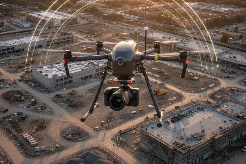
Each flight produces a 1–2 cm/px orthomosaic and a high-resolution 3D mesh you can measure, annotate and share.

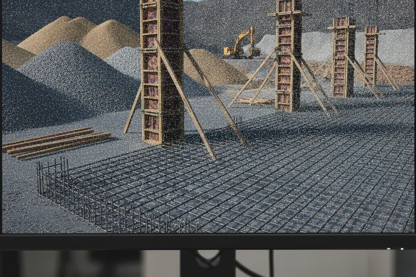
Dense LAZ, LAS and E57 point clouds, georeferenced and ready to drop straight into BIM, Civil 3D and digital-twin pipelines.
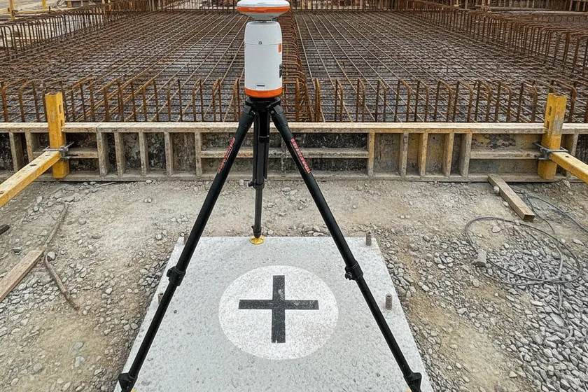
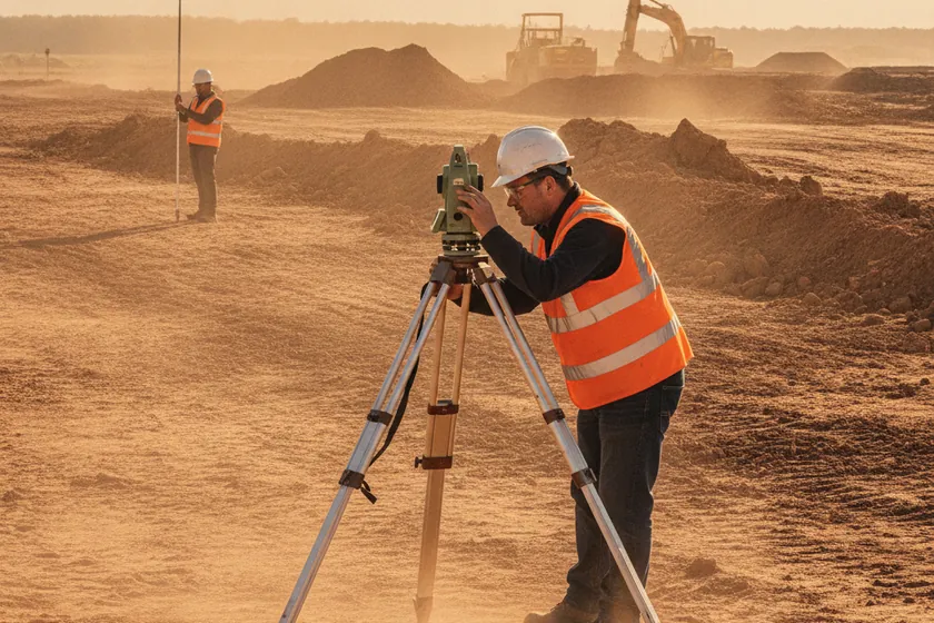
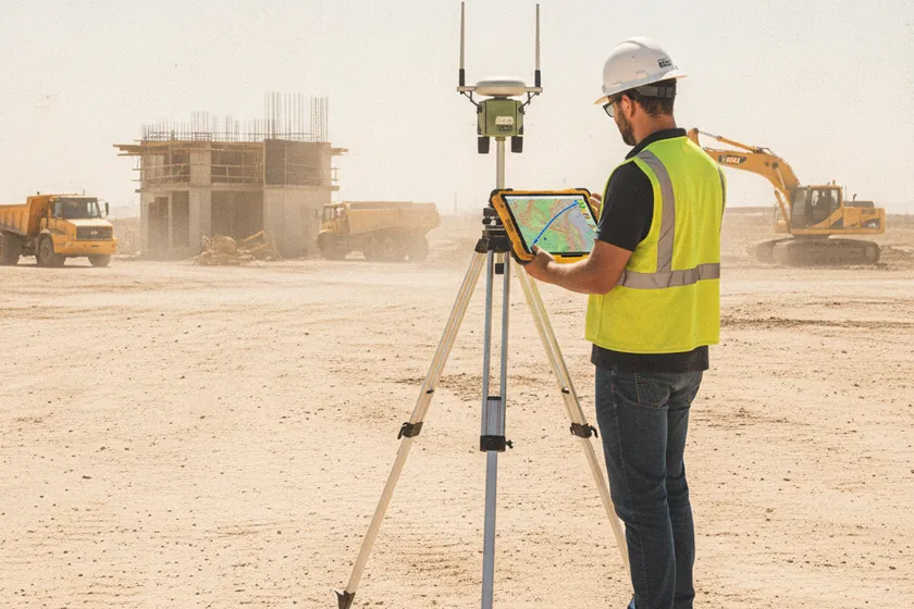
RTK GPS paired with permanent GCPs delivers ±1–3 cm absolute accuracy on every mission and every output.
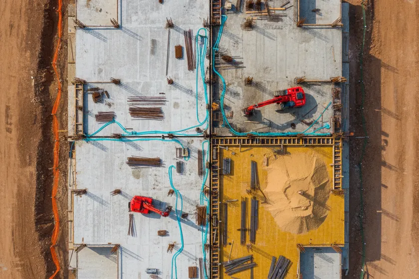
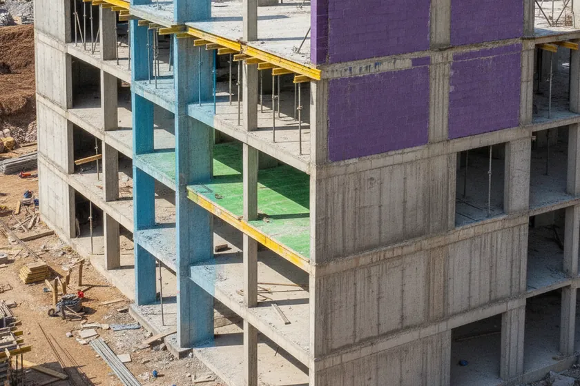
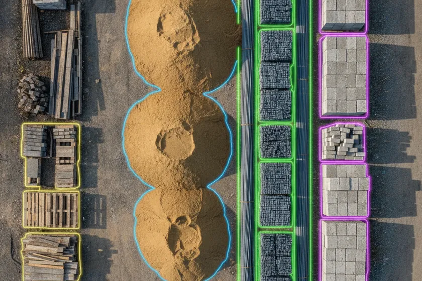
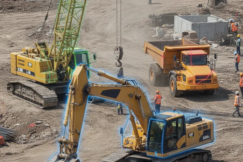
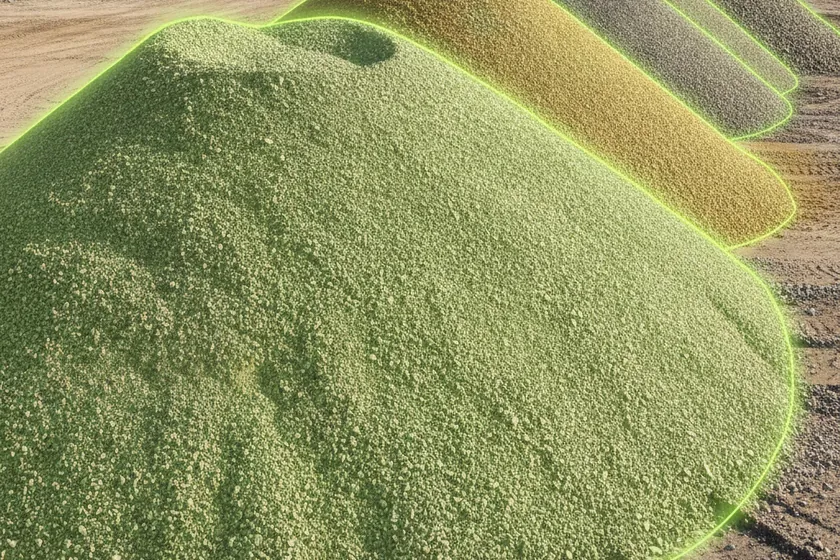
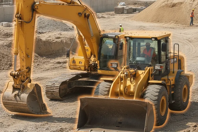
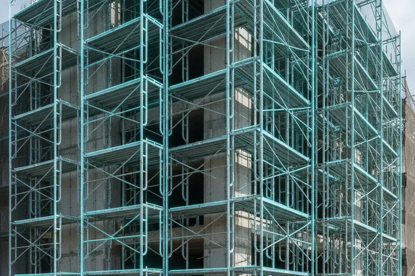
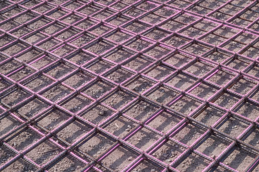
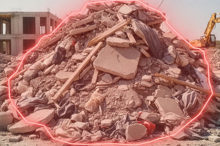
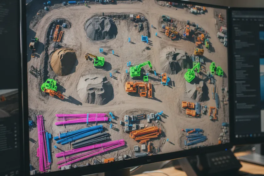
A purpose-built model labels every frame across 12 construction classes — slabs, rebar, MEP, formwork, stockpiles, equipment and more.
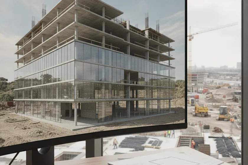
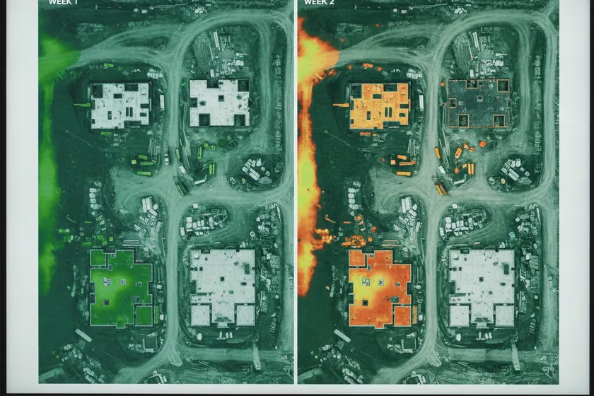
Each flight refreshes a 4D digital twin, so progress, cut/fill, stockpile volumes and layout are always current and auditable.

All processing runs on edge hardware hosted in-Kingdom, so imagery, point clouds and models never leave the country.
Plan flights, review orthomosaics, compare as-built to BIM and export LAZ, LAS, E57, GeoTIFF and PDF deliverables — all from a single app.
RTK GPS, permanent GCPs and calibrated optics deliver ±1–3 cm absolute accuracy on every orthomosaic and point cloud.
Forward and side overlaps, GSD and bundle adjustment are tuned for 1–2 cm/px outputs across the full site.
A trained model labels every frame across 12 construction classes — slabs, rebar, MEP, formwork, stockpiles, equipment and more.
Each flight rebuilds a 4D digital twin, so progress, cut/fill and stockpile volumes are always up to date.
Inference runs on edge servers at your site; imagery, point clouds and models stay inside the Kingdom.
04
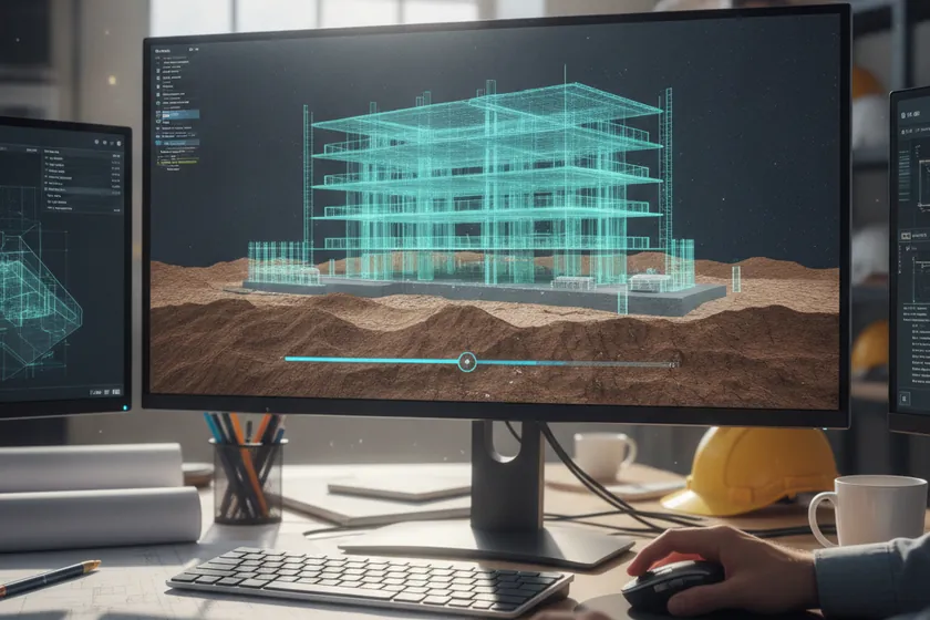
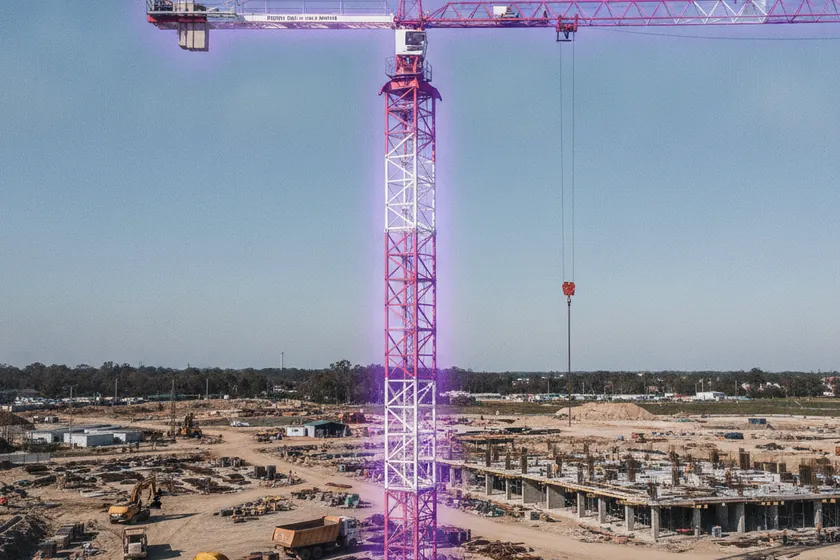
We adapt to your existing stack, no rip-and-replace. ViewKeeper connects to your BIM platform, project-controls tools, on-site CCTV, and drone-in-a-box docks. Drone flights, photogrammetry, and AI analytics run alongside what you already use; in most projects nothing changes for the teams already in place.
Reuse your BIM, schedule, and project-controls tools as they are. ViewKeeper ingests Revit, Civil 3D, Navisworks, Primavera P6, and MS Project models directly, no model-conversion gymnastics.
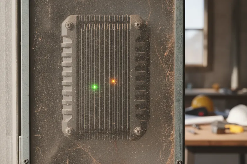
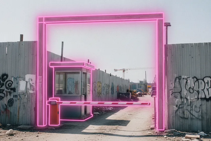
A compact on-site edge unit pulls existing CCTV streams over RTSP / ONVIF, while a drone-in-a-box dock (e.g. DJI Dock) uploads imagery on landing. Both work in parallel with your current systems, no downtime.
A pre-deployment aerial and site survey (included) checks flight corridors, base-station placement, BIM accuracy, and camera coverage, so you know exactly what is needed before any commitment.
We integrate with the leading BIM and project-controls platforms used in Saudi construction, syncing as-built progress, point clouds, and reports directly into the systems your project team already runs. Need a custom connector? The open REST API and webhooks push events and assets into any tool, no middleware required.
| Parameter | Minimum | Recommended |
|---|---|---|
| Orthomosaic GSD | 3 cm/px | 1–2 cm/px |
| Point density | 100 pts/m² | 500+ pts/m² |
| Vertical accuracy | ±5 cm | ±1–3 cm (GCPs / RTK) |
| Horizontal accuracy | ±5 cm | ±2–3 cm |
| Output formats | GeoTIFF, OBJ | DWG, LAS / E57, GeoTIFF, PDF |
Hosted in-Kingdom on AWS sa-central-1 (Riyadh), so orthomosaics, point clouds, BIM deltas, and progress data stay in Saudi Arabia under CITC and SDAIA-aligned controls.
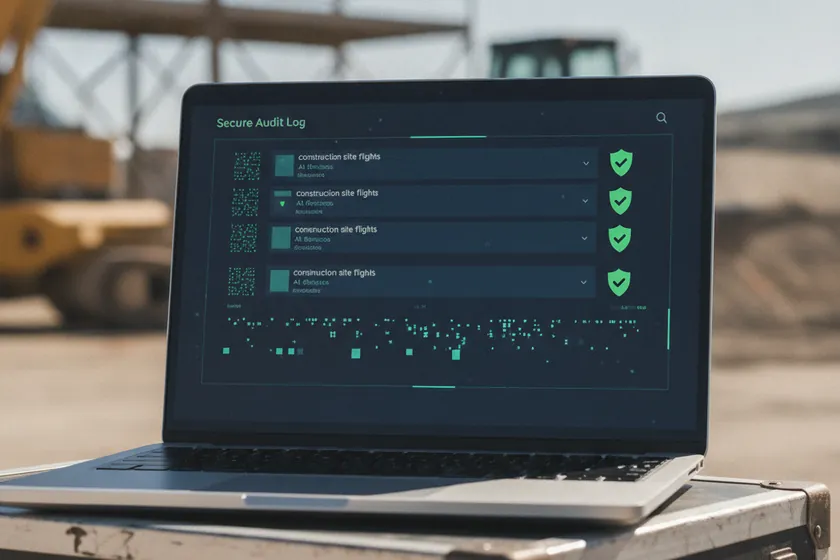
Open REST API and webhooks push progress %, alerts, and assets into Procore, Primavera, ACC, and your own dashboards, with full audit logs.
Edge pre-processes imagery; only derived products (orthos, point clouds, change deltas, JSON events) are uploaded, keeping bandwidth light.
Browser-based viewer and approvals, no installs for the project team, with role-based access for client, consultant, and contractor.
05
What the platform tracks across your construction site — structures, earthworks, equipment, materials and access. 12 classes to start, each detected on your drone and camera feeds with a pixel-precise segmentation mask, never a crude box.
06
Plan
Capture
Segment
Compare
Quantify

Report
Evidence
Audit
07
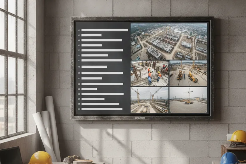
Built for the construction project team. One console for progress dashboards per tower and zone, deviation and schedule alerts, stockpile and equipment views, BIM-vs-site comparisons, and exportable evidence packs. Every alert traces back to the drone flight that raised it, the zone it sits in, the moment it happened, and the confidence the AI gave it. Live today at viewkeepersa.com.
 ViewKeeper App · Overview
Seven pages, live in our construction monitoring app today. The images below come straight from the running build. These are the same screens your project team will open on day one.
viewkeepersa.com
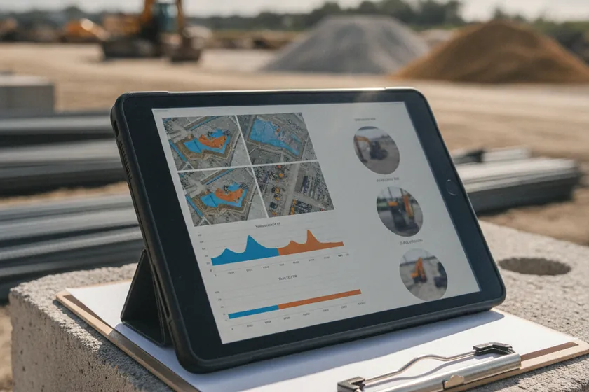
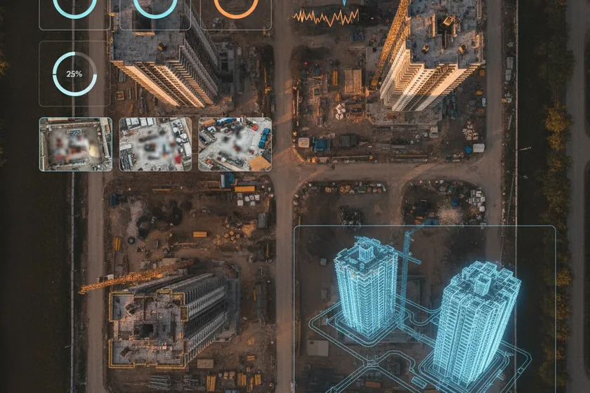
The construction landing page. A live progress percentage per tower, schedule slip indicators, open BIM deviations and critical findings run across the top, next to drones online and mean survey turnaround. Below sits a 24-hour deviation breakdown, the hottest zones ranked, and a 3D digital-twin map of the site.
 viewkeepersa.com
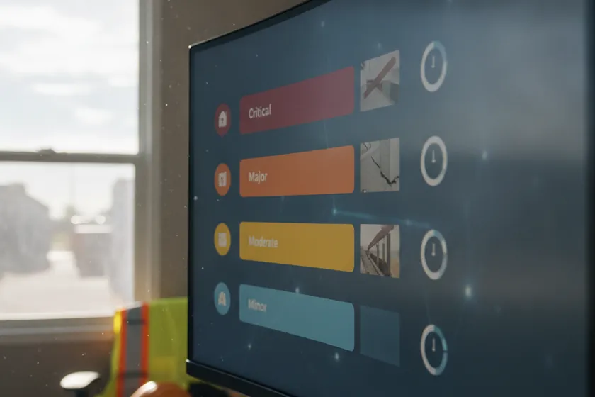
The working queue of progress events. Each one tagged by type, with the flight and zone that caught it, a severity, a confidence score and a status. A reviewer verifies, assigns or closes, and the response clock keeps the team honest.
 viewkeepersa.com
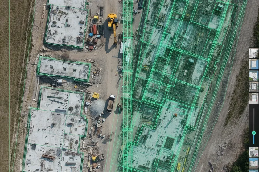
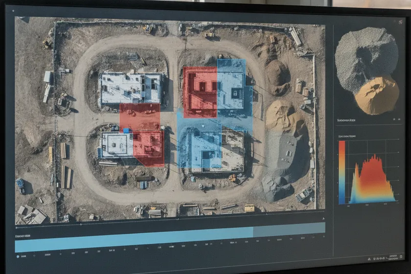
Every orthomosaic, 3D mesh and BIM overlay by site and zone, with live thumbnails, last-flight date and the deviations it raised. A reviewer sees what changed since the last survey before the morning stand-up.
 viewkeepersa.com
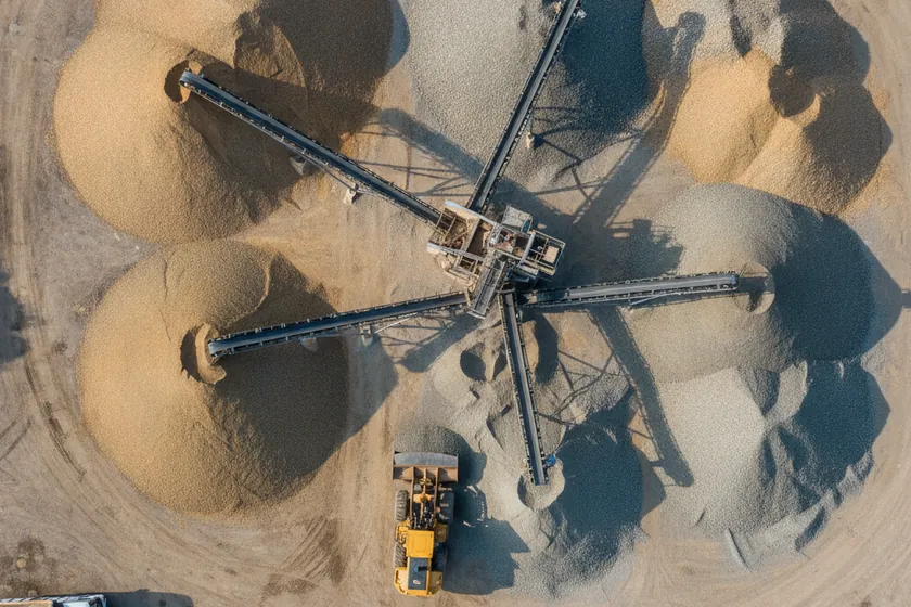
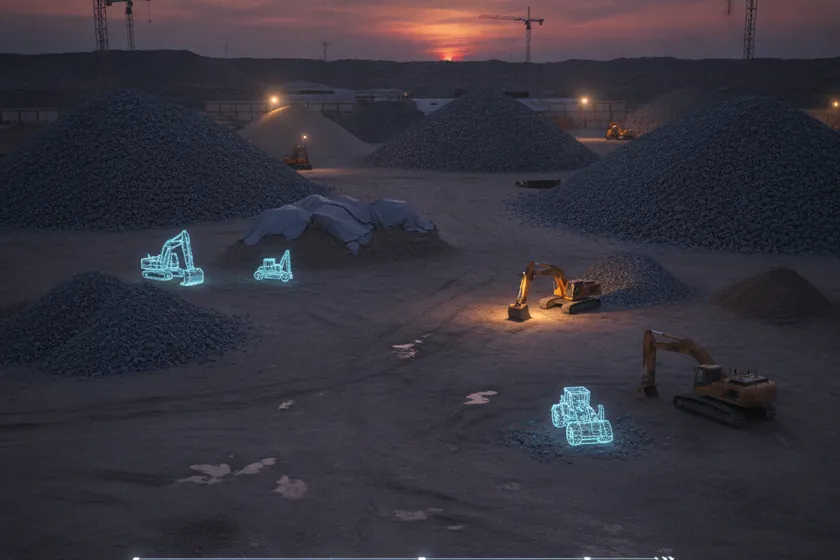
Stockpile volumes measured from the air, equipment positions tracked across flights, and material flow logged against the schedule, so the quantities the QS team audits are kept automatically to within ±1–3 cm of survey accuracy.
 viewkeepersa.com
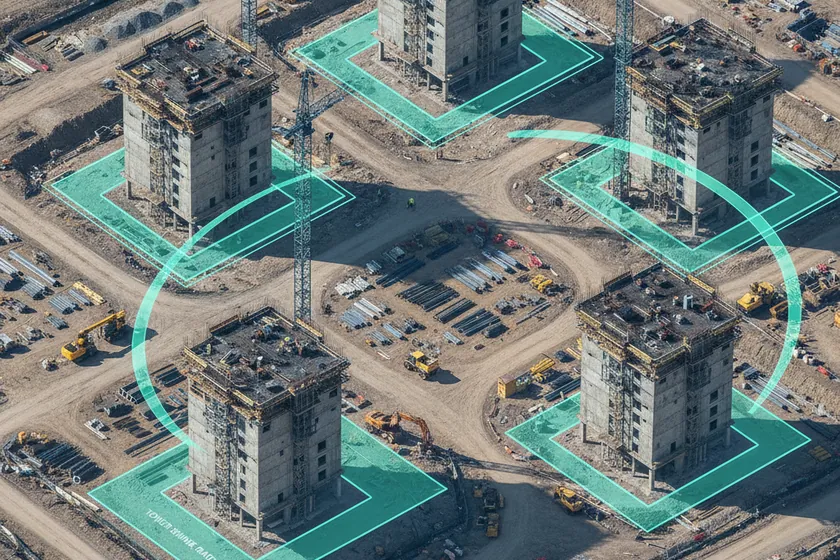
Site zones drawn on the plan and the 3D model: tower footprints, lay-down areas, crane radii, restricted access. Each zone carries its own progress rules, and any deviation shows up in Events with the zone attached.
 viewkeepersa.com
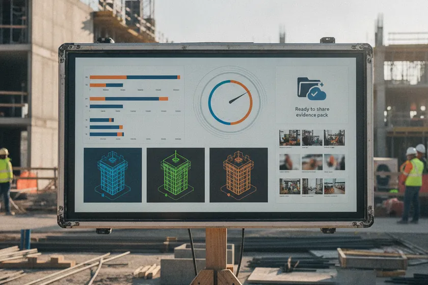
Weekly progress summaries, per-tower BIM exports and evidence packs are generated automatically and shared with stakeholders in one click. Side-by-side overlays, before/after cuts and signed PDFs land straight in the client's inbox.
 viewkeepersa.com
A live AI scan page: drop in a drone flight or pick a stored capture, and the engine outlines progress, BIM deviations and stockpile change on the spot. The fastest way to see the detection quality on your own site.