Drone surveying for construction in Saudi Arabia is now the fastest way to map a site, track progress, and prove volumetric quantities to consultants and clients — and in 2026, on giga-projects like NEOM, Qiddiya, and Diriyah, it's effectively standard practice. A single RTK-equipped drone crew can map 50–150 hectares per day with 1–3 cm horizontal accuracy, replacing 2–3 weeks of ground survey work. The rest of this guide breaks down the methods, costs, GACA permitting, and the Saudi-specific operational realities (heat, dust, PDPL) that decide whether a drone program actually pays off on your project.
Why drone surveying matters for Saudi construction in 2026
Three forces are pushing Saudi builders toward aerial survey:
- Vision 2030 delivery pressure. With NEOM (USD 500 bn program), Qiddiya, Diriyah, Red Sea Global, Roshn's 400,000+ housing pipeline, and Riyadh's expanding metro and event infrastructure, contractors are reporting monthly — sometimes weekly — progress claims. A drone pass on Friday produces a verifiable point cloud by Sunday.
- Consultant and client expectations. Most tier-one PMC and engineering firms (and many government owners) now require as-built orthomosaics, BIM overlays, or volumetric reconciliation as part of the monthly progress report. Two years ago this was a "nice to have." Today it's a contract clause.
- HSE exposure. Heat illness, working-at-height, and confined-space incidents dominate Saudi construction safety statistics. Drones replace the human in the loop for façade, roof, and stockpile inspections — the highest-frequency tasks in any safety plan.
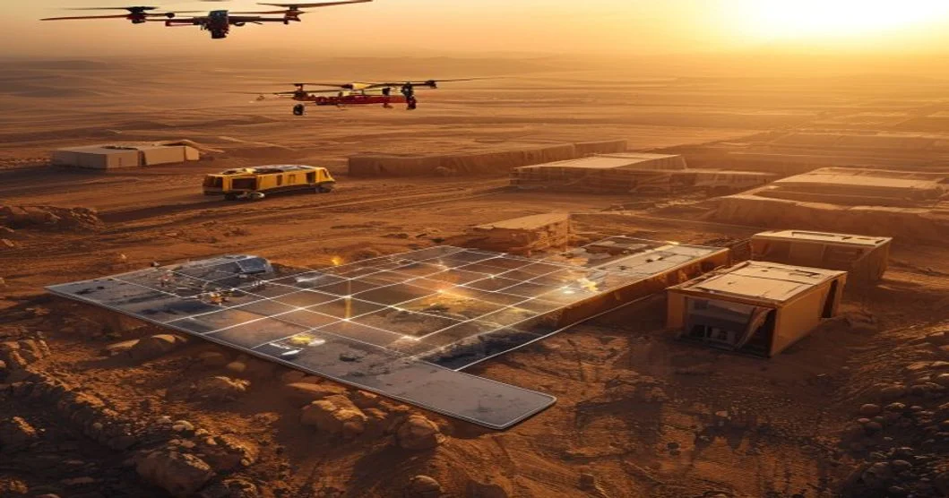
What "drone surveying" actually means on a jobsite
Drone surveying is not one thing. On a Saudi project, you'll typically see five different flight types deployed across the lifecycle:
- Topographic / as-built mapping — photogrammetry (RGB) or LiDAR to produce a georeferenced orthomosaic, DSM, DTM, and contour plan.
- Progress monitoring — repeated flights on a 1–4 week cadence to compare actual vs. planned against the BIM/4D model.
- Earthworks volumetrics — cut/fill calculations for bulk excavation, roadbeds, and stockpile reconciliation.
- Asset and façade inspection — high-resolution oblique or close-range imagery for quality, snagging, and condition surveys.
- Thermal and gas detection — RGB + thermal payloads for heat-signature inspections (roofs, substations, pipelines) and methane/VOC screening.
The drone is the sensor carrier. What you actually buy is a deliverable: a point cloud, an orthomosaic, a heatmap, a measured volume, or an annotated defect register.
How a drone survey works on a Saudi construction site
A clean workflow is what separates a useful drone program from a folder of pretty photos. The standard 5-step path looks like this:
- Scope and ground control. Define deliverable (DTM, volume, ortho, BIM overlay), accuracy target, and coordinate system (typically KSA-GRF / KSA-VRF or the project's local grid). Place 5–10 ground control points (GCPs) or use an RTK/PPK base for direct georeferencing.
- Permitting. Confirm airspace class, proximity to airports/military zones, and apply for a GACA Special Flight Operations Certificate (SFOC) where required. NEOM and some royal-commission zones have their own UAS frameworks layered on top of GACA.
- Flight planning and capture. Plan grid or oblique missions (e.g., 80 m AGL, 80/70 overlap for photogrammetry; 100–150 m AGL for LiDAR). A two-person crew typically flies 50–150 ha/day depending on terrain and overlap.
- Processing and QA. Photogrammetry (PIX4D, Metashape, DJI Terra) or LiDAR (LAStools, TerraSolid) produces a classified point cloud. QA against checkpoints — target ≤3 cm RMSE horizontal, ≤5 cm vertical for engineering-grade work.
- Delivery and integration. Outputs in GeoTIFF, LAS, RCP, or directly aligned to BIM via Revit/Navisworks plugins. Volume tables, progress dashboards, and a short PDF for stakeholders.
A typical first survey on a 100-hectare site takes 2–4 calendar days end-to-end (planning + permit + fly + process + deliver). Repeat flights, once the workflow is set, run in 24–48 hours.
Key applications on Saudi projects
Earthworks and volumetrics
Bulk cut/fill is where drone survey earns its keep the fastest. Stockpile and borrow-pit volume accuracy is typically ±1–3% when the survey is flown with RTK/PPK and a calibrated sensor — good enough for monthly IPC reconciliation. For tier-one contractors in KSA, this alone often justifies the program in a single month.
Progress monitoring and 4D BIM
Weekly or bi-weekly flights layered on a 4D BIM model let project directors see, in one view, what was scheduled vs. what was actually built. Common KPIs: % complete by zone, structure vs. MEP progress, and trade productivity (sqm of formwork placed per day).
HSE and safety inspections
Drones replace the human in the highest-risk routine tasks: tower-crane and boom inspections, scaffolding checks, roof and façade surveys, and perimeter patrols. For sites covered by the Saudi HSE regulatory framework, a drone audit trail is also defensible evidence in incident reviews.
NEOM, Qiddiya, and the linear-project pattern
NEOM's The Line, Qiddiya's resort plateau, and Red Sea Global's coastal corridors share a common survey challenge: long, narrow, evolving corridors that are hard to traverse by ground crew. Corridor LiDAR (mobile or drone-based) is the workhorse — mapping 5–20 km of right-of-way per day with decimeter-grade accuracy.
Thermal, dust, and environmental
Thermal payloads (640×512 minimum) are used for roof moisture surveys, solar-farm commissioning, and substation inspections. RGB cameras with calibrated NDVI plugins are used for landscape and tree-survival audits on Roshn and Diriyah projects.
Drone survey cost in Saudi Arabia: what to budget
Prices in KSA vary with site access, sensor type, accuracy requirement, and reporting depth. The table below reflects typical 2025–2026 market ranges for a mid-size Saudi contractor or developer. Always confirm with a current quote — fuel, crew mobilization to remote giga-project sites, and SFOC complexity can swing the number by 30–50%.
| Method | Typical accuracy | Coverage rate | Indicative cost (SAR / hectare) | Best fit on a Saudi project |
|---|---|---|---|---|
| Conventional ground survey (total station + GPS) | ±1–2 cm | 2–5 ha/day | 800–1,500 | Small plots, dense urban infill, boundary disputes |
| Drone photogrammetry (RTK/PPK, GCPs) | ±2–5 cm horiz., ±3–6 cm vert. | 50–150 ha/day | 80–250 | Monthly progress, volumetrics, orthomosaic |
| Drone LiDAR (UAV-mounted) | ±3–5 cm vert., dense vegetation penetration | 40–120 ha/day | 250–600 | Corridors (NEOM/Red Sea), vegetated terrain, complex sites |
| Mobile / vehicle-mounted LiDAR | ±2–4 cm | 5–20 km/day | Quoted per km | Long linear infrastructure, roads, utilities |
| Satellite / aerial photogrammetry (manned aircraft) | ±10–30 cm | Hundreds of ha/hour | 30–80 | Regional master planning, not IPC |
For a 100-hectare monthly monitoring program, drone photogrammetry typically lands at SAR 8,000–25,000 per month including processing and a one-page dashboard. The same area surveyed conventionally can run 5–10× that — and take weeks longer.
GACA drone permit and regulatory checklist
Flying commercially in KSA is regulated by the General Authority of Civil Aviation (GACA). The headline rule: no commercial drone operation without authorization. In practice, a Saudi construction survey looks like this:
- Operator registration with GACA and a valid UAS operator authorization (the requirements have been progressively tightened since 2023 — verify the current circular before bidding).
- Pilot certification: GACA-recognized remote pilot license, with the relevant subcategory for the aircraft weight class used.
- SFOC (Special Flight Operations Certificate) for each project, or a project-level blanket authorization on multi-year giga-projects.
- Airspace check: not within 5–8 km of controlled airports, military zones, or royal premises without specific clearance. Riyadh's KKIA and Jeddah's KAIA have published UAS exclusion zones.
- Insurance: third-party liability coverage is generally required as part of the SFOC submission.
- On-site documentation: a flight log, daily checklist, and a copy of the SFOC kept with the crew.
For sensitive sites (NEOM, Royal Commission zones, MOD areas), expect an additional 2–6 weeks of layered approvals and a dedicated coordinator.
Heat, dust, and weather: the Saudi operational reality
You can plan the perfect mission and still get burned by the environment. Three Saudi-specific factors shape every flight window:
- Heat. Summer ground temperatures in Riyadh and the Eastern Province regularly exceed 50 °C; air temps above 45 °C are normal from May to September. Most consumer-grade sensors throttle or fail above 40 °C ambient. Industrial-grade drones (Matrice 350, WingtraOne, etc.) and early-morning flight windows (05:30–08:30) are the workaround. Battery cycles drop 15–25% in peak heat.
- Dust and shamal winds. Spring shamals can push sustained winds above 40 km/h for 48–72 hours. Dust also degrades image quality and clings to lenses — plan cleaning intervals and post-process haze filters into the workflow.
- Humidity on the coast. Jeddah, Yanbu, Dammam, and the Red Sea coast see high humidity and salt haze. LiDAR returns degrade, and optics need anti-fog treatment and frequent calibration.
A useful rule of thumb: plan on two flyable days out of every seven in July–August inland, and 4–5 in coastal cities. Most Saudi drone programs schedule heavy capture in October–April and shift to processing, BIM integration, and reporting work in summer.
Data, PDPL, and what you actually receive
The deliverable is the product. A professional Saudi survey should hand you:
- Orthomosaic (GeoTIFF, typically 1–3 cm/px GSD) and a DTM/DSM for the full site.
- Classified point cloud (LAS 1.4) for BIM alignment.
- Volumetric report with cut/fill tables and a signed surveyor's declaration where the contract requires it.
- Progress dashboard (web or PDF) with annotated photos mapped to zones, % complete, and deviation flags against the BIM model.
- Raw data on request — for the client's own archive and for dispute resolution.
Under Saudi Arabia's Personal Data Protection Law (PDPL), in force since September 2024, drones that incidentally capture identifiable faces or license plates on or near the site require a documented lawful basis for processing. In practice this means: avoid overflying occupied worker housing without a purpose limitation, blur faces in published dashboards, and keep the raw imagery in a controlled archive. The PDPL fines scale with turnover, so treat this as a contractual line item, not a footnote.
Frequently asked questions
How much does a drone survey cost in Saudi Arabia?
For a typical 50–150 hectare construction site, monthly drone photogrammetry monitoring in KSA runs SAR 8,000–25,000 per month including processing and reporting, with one-off topographic baselines at SAR 80–250 per hectare. LiDAR corridors and complex giga-project environments can run 2–3× higher due to mobilization, sensor cost, and SFOC complexity. Always request a per-hectare and per-flight breakdown.
Do I need a GACA permit to fly a drone on a construction site?
Yes, for any commercial operation. You need a GACA UAS operator authorization, a GACA-recognized pilot certificate, and a project-level SFOC. Sites near airports, military zones, or under Royal Commission jurisdiction may need additional clearances that add 2–6 weeks. The penalties for flying without authorization have increased materially — build permitting time into your project plan, not after.
How accurate is drone surveying for earthworks volumetrics?
With an RTK/PPK drone, calibrated sensor, and 5–10 ground control points, expect ±1–3% volumetric accuracy and 2–5 cm horizontal / 3–6 cm vertical on the point cloud. That is comfortably within the tolerance most consultants accept for monthly IPC and final account reconciliation in KSA.
Can drones fly in Saudi summer heat?
Yes, with the right equipment and scheduling. Industrial airframes rated to 45–50 °C ambient, early-morning flight windows, and reduced battery cycles are the norm. Inland sites typically have 2 flyable days per week in July–August; coastal Jeddah and Dammam fare better. Plan heavy capture for October–April.
The bottom line
Drone surveying for construction in Saudi Arabia has shifted from competitive advantage to baseline expectation. On a 100-hectare project, the math is straightforward: a drone program at SAR 8,000–25,000 a month replaces 5–10× that in conventional survey cost, cuts progress reporting cycles from weeks to days, and gives your HSE team eyes on every roof, façade, and stockpile without sending a person up a ladder.
ViewKeeper runs drone surveying and AI video analytics programs across Riyadh, Jeddah, NEOM, Qiddiya, and the Red Sea coast — with GACA-cleared crews, RTK/PPK workflows, PDPL-aware data handling, and deliverables that drop straight into your BIM environment. If you'd like a scoped proposal for a baseline, monthly, or corridor survey on your project, get in touch and we'll send a one-page plan within 48 hours.