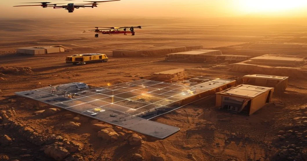
Drone survey cost per hectare in Saudi Arabia in 2026 typically falls between SAR 250 and SAR 1,800, depending on the sensor, terrain complexity, and deliverable you need. Photogrammetry sits at the lower end (SAR 250–600/ha), while LiDAR and multi-sensor packages climb to SAR 800–1,800/ha. Giga-projects (NEOM, Qiddiya, Red Sea, Diriyah) usually negotiate volume rates 20–40% below published numbers.
What actually drives the rate per hectare
The per-hectare figure isn't a fixed menu item. Five variables decide what you pay:
- Sensor payload. RGB photogrammetry is the cheapest because the hardware is commoditized. LiDAR pushes cost up 2–3x. Thermal and multispectral add another 30–60% on top of RGB.
- Ground control and GCP density. Open desert with stable GNSS base stations is fast. Urban or industrial sites with restricted GPS, metallic interference, or no safe GCP placement need more flight lines, more passes, and longer processing.
- Terrain and accessibility. Flat as-built sites at grade fly in 20 minutes. Rocky wadis, dense urban canyons, or active live-plant facilities (refineries, process plants) need shorter segments, repeated flights, and more manual processing.
- Deliverable type. A raw orthomosaic and DEM is standard. If you want classified point clouds, contour lines, volumetric cut/fill reports, BIM-ready meshes, or change-detection deltas, the processing time — and therefore the price — climbs.
- Mobilization. If your site is in a Tier 1 city (Riyadh, Jeddah, Dammam), mobilization is cheap. NEOM, AMAALA, or remote mining sites in Waad Al-Shamal add SAR 5,000–25,000 in travel and per diem before the first hectare is even flown.
A practical rule: two surveys with the same hectare count can vary by 3–4x in price if one is open desert and the other is a live refinery under PDPL-scoped access controls.
2026 price ranges: photogrammetry, LiDAR, and multi-sensor
The numbers below are realistic ranges across the Saudi market in 2026, based on what Tier 1 and Tier 2 survey firms are quoting for commercial and government work. They exclude VAT.
| Survey type | Typical SAR / hectare | Absolute accuracy | Best fit | Turnaround |
|---|---|---|---|---|
| RGB photogrammetry (ortho + DSM) | 250 – 600 | ±3–5 cm horizontal, ±5–10 cm vertical | Stockpile volumes, progress tracking, as-built vs design | 3–7 days |
| LiDAR survey (classified point cloud) | 800 – 1,800 | ±2–3 cm vertical, ±3–5 cm horizontal | DTM under canopy, corridor mapping, design-grade topo | 5–14 days |
| LiDAR + RGB fused | 1,200 – 2,200 | ±2–3 cm | Engineering design, BIM, clash detection | 7–14 days |
| Thermal / multispectral overlay | +30–60% on RGB | n/a (radiometric) | HSE inspections, PV plant audits, irrigation | 3–10 days |
| Volumetric / cut-fill reporting (add-on) | +SAR 80–150/ha | inherits base survey | Earthworks verification, monthly progress claims | 1–3 days |
For a 10-hectare construction site in a Tier 1 city, expect a photogrammetry survey to land at SAR 2,500–6,000, and a LiDAR package at SAR 8,000–18,000. The same 10 hectares in a remote NEOM or AMAALA zone adds SAR 8,000–15,000 in mobilization on top.
How project size changes your unit rate
Most Saudi survey firms price in tiers. The bigger the hectarage under one mobilization, the lower the per-hectare rate because fixed costs (travel, setup, GCPs, processing setup) get amortized.
- Under 5 ha — Premium rate, often SAR 600–900/ha for photogrammetry. Small site, but the crew still needs to mobilize, set GCPs, and process. The fixed cost per hectare is high.
- 5–25 ha — Standard commercial rate. SAR 350–600/ha for photogrammetry, SAR 900–1,500/ha for LiDAR. This is the sweet spot for monthly construction progress surveys.
- 25–100 ha — Volume tier. SAR 250–400/ha for photogrammetry. Single setup, multiple flight blocks, single processing pipeline. The efficiency gain is real.
- 100–500 ha — Corridor and infrastructure tier. SAR 200–350/ha. NEOM linear infrastructure, road corridors, pipeline routes, and utility ROW work sits here.
- 500+ ha — Giga-project tier. SAR 150–300/ha, often bundled into multi-year framework agreements. NEOM, Qiddiya, and Red Sea Global have framework deals that look very different from the published rate card.
If you only need 3 ha surveyed, you'll pay more per hectare than if you need 30. The way to get a better unit rate on a small site is to bundle it with other small sites in the same region into a single mobilization.
Saudi-specific factors that move the number
GACA and operational permits
Every commercial drone flight in KSA needs a GACA (General Authority of Civil Aviation) permit for beyond-visual-line-of-sight (BVLOS) operations over controlled areas, near airports, or above 400 ft AGL. Permit lead time is 5–15 working days depending on the airspace class. Some firms absorb permit cost into the rate; others pass it through as a separate line item, typically SAR 2,000–8,000 per project.
Restricted airspace around military zones, royal airports, and Aramco facilities adds lead time and sometimes requires escorted flights. Plan for this on giga-projects.
Heat, dust, and the May–September window
Summer ground temps in central and eastern Saudi regularly hit 48–55°C. Dust storms (shamal winds) can ground a drone fleet for 24–72 hours. Both reduce daily flight hours per crew from ~6 hours in winter to 2–3 hours in peak summer. Survey firms price this in two ways:
- Seasonal rate uplift of 10–25% for work scheduled June through August.
- Productivity assumption — firms quoting a low per-hectare rate in summer are often assuming 8 hours of flying per day. Push them to confirm their daily flight-hour assumption in writing.
The smart move is to schedule volumetric cut/fill and progress surveys in the October–April window. You get more flying hours per day, and the same rate buys more hectares.
PDPL and site access
Saudi's Personal Data Protection Law (PDPL), fully enforced since September 2024, applies to drone surveys that capture identifiable people, faces, or license plates. On a closed construction site this is usually fine. On a public-facing site, mixed-use development, or any project near a populated area, the survey needs to blur faces/plates in post-processing, or fly outside operational hours.
Expect a 5–10% processing surcharge for PDPL-compliant deliverables, and a longer processing timeline.
Localization and Aramco/SAUDIA contract terms
If your project is Aramco, SADARA, SABIC, or under a Royal Commission framework, the supplier may need to meet ICV (In-Kingdom Value) thresholds, use only GACA-licensed operators, and comply with site-specific HSE standards. The unit rate may look higher than the market average, but the indirect cost of using a non-compliant supplier is far worse.
How to read a drone survey quotation in KSA
A clean quotation breaks the cost into the line items you can actually challenge:
- Mobilization and demobilization — fixed cost, not per hectare. Watch for this being double-counted across multiple sites.
- Permit fees (GACA) — should be a pass-through, not a margin line.
- Flight operations — per hectare, with a stated GCP density and flying height (usually 80–120 m AGL for photogrammetry, 60–100 m for LiDAR).
- Data processing — per hectare or per deliverable. Ask what software they use (Pix4D, DJI Terra, RealityCapture, Bentley ContextCapture) and whether the deliverable is georeferenced to KSA's national grid (KSA-GRF17) or to a local project grid.
- Reporting and QA/QC — ortho mosaic, DEM, contours, volumetric report, or BIM export. Each is a separate processing step.
- Optional add-ons — thermal, multispectral, change detection, 360 walkthrough, web-based viewer.
Two quotes at the same per-hectare rate can be very different in scope. Always ask for a sample deliverable package and a sample report before signing.
Frequently asked questions
How much does a drone survey cost per hectare for a typical Riyadh construction site in 2026?
For a 10–25 ha site with open access, photogrammetry runs SAR 350–600/ha. LiDAR for design-grade topography runs SAR 900–1,500/ha. Add SAR 3,000–6,000 for GACA permits and mobilization if it's a one-off job.
Is LiDAR worth the extra cost over photogrammetry in Saudi Arabia?
For most construction progress and stockpile work, no — photogrammetry is sufficient and faster. LiDAR earns its premium on three use cases: (1) vegetated or terrain with poor photo texture, (2) corridor mapping for roads and pipelines under design, and (3) BIM-grade as-built capture for clash detection. On desert sites with no vegetation, photogrammetry is the better value.
How long does a drone survey take on a NEOM or giga-project site?
Mobilization plus 1–3 flight days for 50–200 ha, plus 5–10 days of processing for a full LiDAR + ortho + volumetric package. Add 5–15 working days if GACA BVLOS permits are required. Framework agreements with pre-approved flight zones cut this by 30–50%.
Can drone surveys be used for monthly progress claims in Saudi Arabia?
Yes, and they increasingly are. The contractor submits a drone-derived cut/fill report tied to a survey control network on KSA-GRF17, and the engineer reviews the point cloud and DEM deltas. The key is to lock the survey methodology, GCP layout, and processing pipeline at the start of the contract — not after the first claim.
The bottom line
Drone survey cost per hectare in Saudi Arabia in 2026 is shaped less by the published rate and more by your project specifics: sensor, terrain, mobilization, GACA airspace class, and PDPL exposure. Photogrammetry at SAR 250–600/ha is the workhorse for monthly construction progress, while LiDAR at SAR 800–1,800/ha is the right tool when you need design-grade accuracy or you're working in vegetated or corridor conditions.
If you want a single number to budget against for a Tier 1 city, photogrammetry, and 10–25 ha, use SAR 400/ha as your working figure. Add 30–50% for LiDAR, 15–25% for summer scheduling, and a fixed SAR 5,000–10,000 for mobilization on remote sites.
ViewKeeper runs drone surveying and AI video analytics across Saudi Arabia, with active work on NEOM, Qiddiya, and major industrial clients. If you want a fixed quotation tied to your site, sensor, and timeline, reach out with your hectare count, location, and deliverable list — we'll come back with a number and a delivery date, not a slide deck.